Title: Hiking Mt Robert in
So the next morning I awake (as I seem to every morning) at 7:30 AM and I am a bit disappointed to see that the grey room has closed in again. Yes we are in the cloud again, and even though we are “inland” – Hope Saddle approximately equidistant from the north, west and east coasts – the grey misting cloud that makes everything drip has the distinct smell of the sea. So, I decide to let Gen sleep while I read in my book. After all what is the hurry? Go hike in the mist at
About 8:30 Gen wakes, and we make the hot water for oatmeal and coffee (our two respective breakfasts). While we are doing our morning re-arranging of the van (at night all the bags move to the front two seats to make room for our sleeping area, it is a vanette and not a van, after all), an older fellow pulls up in an absolutely beautiful, obviously well taken care of 1976 Toyota Landcruiser with a snorkel. I say, “what a beautiful jeep! I bet that will take you places.” He smiles, and says, “You know what is the best thing about her?” and honks the horn, and it makes this old granny type of honk! He then pops the hood and shows me the Nissan diesel engine in it, and says that it will run no matter where you take it, and tells me that he has had it in such deep water that the interior of the car has flooded out. “Can’t stop a good diesel engine,” he says. So this starts another about ½ hour long conversation, where he shares with Genevieve a bunch of information about the various plants around the car park, “Now this is a flax plant, you can eat the fruit at the very center of it.” And “Oh I guarantee there are kiwi (birds) in this bit of brush right here.” And, “It is easy to live cheaply in
His name is Lance, lives in Nelson, and stops here as a matter of habit to stretch his legs while driving between Nelson and the gold mine he works at 6 days at a stretch somewhere on the west coast. “Six days on, six days off, 12 hours a day…. I can drive any of their machines, so I never know what I’m going to do.”
We found it ironic that he deplored the small amount of garbage at the rest stop, while he worked in a modern gold strip mine! “We went in there where the old fellas had made shafts, and we are taking out the whole mountain. We are about a kilometer in diameter and at about 200 meters deep. The deeper we go, the richer the find. About $3.5 million/day, they are making….So much gold you can just pick it up off the ground and see it in your hands, but don’t put your hand in your pockets! Instant dismissal, that is. Gold on the cab floor, gold in all the machinery, gold along the roads, gold everywhere.” He also shared his disdain for foreign tourists, as we shared Genevieve’s coffee with him, “Oh that’s good coffee, that is.” He continued, “I’d say don’t let any of them in, throwing their garbage about, but you gotta take the good with the bad. I love it here, lived here all my life, seems only fair to share it with them, too.” Another interesting character.
And on sharing his love of the land, he shared this little tidbit, “Best thing about
He was a wealth of information, like Ann was on the Queen Charlotte hike, just a little bit different info. He told us that they had found a female Tuatara, a native lizard that had been thought to be extinct except for the specimens in captivity. He also told me that only 1 million people live on the South Island (or something like one person per 100 sq km), and that there were whole huge parts of the Island that have never been explored by whites. So Genevieve’s hope to see a Moa (a huge flightless bird, bigger than an ostrich), was confirmed by Lance, “I am sure there is some of them somewhere, we just haven’t found them yet.” It was kind of re-assuring after finally figuring out that all these big evergreens with their lower branches all pruned up, growing in nice tidy rows along most of the highways are all actually tree farms, that there was still lots of unexplored
So we collected our things and headed for
At the Mt Robert Car park in Nelson Lakes National Park, we met yet another great NZ character also filled with fascinating facts. Apparently, all the landscape near the Park is only 3 to 5 million years old, as we were at or near a fault line between the Australia Plate and the Pacific Plate. He warned us to be on the lookout for the indigenous Green Parrot, called the Kea, as it will eat anything and everything. “It’ll eat your car if you let it. Its true, ask the rental car people. Dang bird eats the windshield wipers, and the rubber off the tires.” He also expressed his disappointment at new farms that were encroaching on the bush of the Park.
The weather started to look as if it might clear again, just like the previous day, so we started up the Mt Robert trail above
So this is a nice hike, but it was a little disappointing as the terrain was the most similar to
So in the treed areas of this hike, the same green moss and ferns and trees as on Mt Arthur are in abundance, and the ground is wet like a sponge (obviously why the trees grow where they do.) Where the track was out in the open, it was hard like any trail in
So as we climbed Mt Robert, it kept looking like we would get into the cloud. But as we climbed the mist cleared before us….Again our luck with the weather and conditions continues to hold. We did get into the cloud, and again, the temperature change is dramatic (much colder). We were again in the grey room, and the views, which were starting to open, closed up around us tight. But by the time we got to the top, the view out the back was stunning…. More snow covered peaks in the distance with lower not snow covered peaks forming the valley edge above the lake to our left.
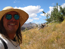
As we sat on the top and had our lunch, the blue-bird day came out in force. My god! The Views were stupendous up here! To the west it was Mountains, with mountains behind them, and then more mountains, and yet another range – five or six ranges, one behind the other to the horizon! And below us to the northwest a beautiful green farm filled valley, with the Owen range towering above it, and to the east/northeast, more green valley to Blenheim in the distance. And to the north smaller, round green mountains covered in trees (tree farms maybe) they called those mountains “Knobs” but mountains they would be called in the
I decided to walk to the edge of Christie’s ridge before heading down the trail to see what was around the ridge in front of us (behind Mt Robert). We were well above tree line here, and the valley below seemed much further down vertically than any back home in
It was worth the ½ hour trip, as even more, incredibly impressive snow covered peaks revealed themselves around the rocky ridge (that made one of the few pictures). One further back, and three or four closer in (the big one must be Angelus), closer to that obscuring ridge. It was spectacular, gorgeous. There is a very distinct tree line at just the same elevation along the valley wall opposite. God I wished I had more pictures from this hike!
As I started my descent, a glider (sailplane?) came gliding overhead silently, so close I could make out its call numbers, TH 4408. He is gaining altitude in this breeze off the shoulder of Mt Robert.
Ah
Another big difference between here and home is that there is always quite a bit of birdsong in the air all the time: morning, day, night, even up here above tree line. And there is no, or virtually no air traffic. That one helicopter, there is another off in the distance – a tour perhaps? The New Zealander pointed out the only jet trail I have seen so far at the beginning of today’s hike...obviously a large annoyance to him. What a difference to hiking in
So we came down the mountain and it is only 4:45PM. How did that happen? The loop was supposed to be 5 hours, and we went well above the loop to the top of the mountain, and we left at 5 to Noon. This is the first time we have been substantially ahead of the estimated time for the hike. (usually we are about 20% over) And we had a leisurely lunch. We decided to get a head start on the west coast trip by driving the 100 or so KM to
Now 100 KM seems like it would not be too far, but wait, remember the six or so ranges of mountains I saw to the west from Mt Robert? Yes, it tooks us about 2:15 to cover those 100 km! Windy, Windy roads. Many curves, steep grades (much steeper than in the
One thing about the misty clouds that so far have dominated the weather on this trip is that it lent a good deal of mystery and drama to the landscape. But today it is a bluebird day, I can see the tops of all the mountains which is a little anticlimactic. We pass the
Another thing is that the amount and variety of trees in this country is truly amazing. I do not know them all, and I am no expert on trees, but jeez, we got like what, three kinds of trees in CO? Evergreen,
On this ride, it just doesn’t stop. We are following this canyon, with its vertical, but oh so green, sides, and wide crystal clear river. And when I think we are going to get through it all and see the sea, no…. More mountains, mountains, mountains.
And on this main highway between Murchison and
So we make it to
But now I have caught up on the blog, and it is 2AM (again) and I am posting and I am going to bed, for tomorrow, I try to call Qantas to change my departure so that I will have time for the “Cannot Miss” Milford Sound ferry ride. After all, Rick wont be in
So until next time
Newo out,
No comments:
Post a Comment